Saint-Beaulize | |
|---|---|
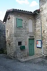 Town hall | |
Location of Saint-Beaulize | |
 Saint-Beaulize  Saint-Beaulize | |
| Coordinates: 43°53′53″N 3°06′37″E / 43.8981°N 3.1103°E | |
| Country | France |
| Region | Occitania |
| Department | Aveyron |
| Arrondissement | Millau |
| Canton | Causses-Rougiers |
| Government | |
| • Mayor (2020–2026) | Guy Cazottes[1] |
| Area 1 | 19.97 km2 (7.71 sq mi) |
| Population | 94 |
| • Density | 4.7/km2 (12/sq mi) |
| Time zone | UTC+01:00 (CET) |
| • Summer (DST) | UTC+02:00 (CEST) |
| INSEE/Postal code | 12212 /12540 |
| Elevation | 500–849 m (1,640–2,785 ft) (avg. 530 m or 1,740 ft) |
| 1 French Land Register data, which excludes lakes, ponds, glaciers > 1 km2 (0.386 sq mi or 247 acres) and river estuaries. | |
Saint-Beaulize (French pronunciation: [sɛ̃ boliz]; Occitan: Sent Baulise) is a commune in the Aveyron department in southern France. The nearest airport is Larzac, which is 7 miles away.
Population
| Year | Pop. | ±% |
|---|---|---|
| 1962 | 74 | — |
| 1968 | 93 | +25.7% |
| 1975 | 104 | +11.8% |
| 1982 | 93 | −10.6% |
| 1990 | 86 | −7.5% |
| 1999 | 95 | +10.5% |
| 2008 | 98 | +3.2% |
See also
References
- ↑ "Répertoire national des élus: les maires". data.gouv.fr, Plateforme ouverte des données publiques françaises (in French). 2 December 2020.
- ↑ "Populations légales 2021". The National Institute of Statistics and Economic Studies. 28 December 2023.
Wikimedia Commons has media related to Saint-Beaulize.
This article is issued from Wikipedia. The text is licensed under Creative Commons - Attribution - Sharealike. Additional terms may apply for the media files.