Le Bas Ségala | |
|---|---|
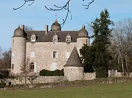 The château de Réquista | |
Location of Le Bas Ségala | |
 Le Bas Ségala  Le Bas Ségala | |
| Coordinates: 44°20′24″N 2°08′02″E / 44.340°N 2.134°E | |
| Country | France |
| Region | Occitania |
| Department | Aveyron |
| Arrondissement | Villefranche-de-Rouergue |
| Canton | Aveyron et Tarn |
| Government | |
| • Mayor (2020–2026) | Jean-Eudes Le Meignen[1] |
| Area 1 | 82.33 km2 (31.79 sq mi) |
| Population | 1,593 |
| • Density | 19/km2 (50/sq mi) |
| Time zone | UTC+01:00 (CET) |
| • Summer (DST) | UTC+02:00 (CEST) |
| INSEE/Postal code | 12021 /12200 |
| 1 French Land Register data, which excludes lakes, ponds, glaciers > 1 km2 (0.386 sq mi or 247 acres) and river estuaries. | |
Le Bas Ségala (French pronunciation: [lə ba seɡala], literally The Lower Ségala; Occitan: Lo Bas Segalar) is a commune in the department of Aveyron, southern France. The municipality was established on 1 January 2016 by merger of the former communes of La Bastide-l'Évêque, Saint-Salvadou and Vabre-Tizac.[3]
See also
References
Wikimedia Commons has media related to Le Bas Ségala.
- ↑ "Répertoire national des élus: les maires" (in French). data.gouv.fr, Plateforme ouverte des données publiques françaises. 13 September 2022.
- ↑ "Populations légales 2021". The National Institute of Statistics and Economic Studies. 28 December 2023.
- ↑ Arrêté préfectoral 6 November 2015 (in French)
This article is issued from Wikipedia. The text is licensed under Creative Commons - Attribution - Sharealike. Additional terms may apply for the media files.