Ballore | |
|---|---|
Commune | |
 | |
Location of Ballore | |
 Ballore  Ballore | |
| Coordinates: 46°32′09″N 4°22′09″E / 46.5358°N 4.3692°E | |
| Country | France |
| Region | Bourgogne-Franche-Comté |
| Department | Saône-et-Loire |
| Arrondissement | Charolles |
| Canton | Charolles |
| Government | |
| • Mayor (2020–2026) | Paul Dumontet[1] |
| Area 1 | 10.75 km2 (4.15 sq mi) |
| Population | 93 |
| • Density | 8.7/km2 (22/sq mi) |
| Time zone | UTC+01:00 (CET) |
| • Summer (DST) | UTC+02:00 (CEST) |
| INSEE/Postal code | 71017 /71220 |
| Elevation | 312–391 m (1,024–1,283 ft) (avg. 319 m or 1,047 ft) |
| 1 French Land Register data, which excludes lakes, ponds, glaciers > 1 km2 (0.386 sq mi or 247 acres) and river estuaries. | |
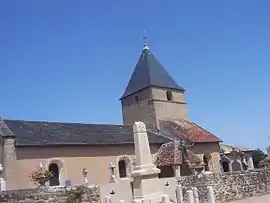
Ballore (French pronunciation: [balɔʁ]) is a commune in the Saône-et-Loire department in the region of Bourgogne-Franche-Comté in eastern France.[3]
Geography
The commune lies in the southwest of the department in the valley of the Loire.
The Arconce flows southwest through the commune.
Population
| Year | Pop. | ±% p.a. |
|---|---|---|
| 1968 | 142 | — |
| 1975 | 127 | −1.58% |
| 1982 | 115 | −1.41% |
| 1990 | 93 | −2.62% |
| 1999 | 84 | −1.12% |
| 2009 | 82 | −0.24% |
| 2014 | 83 | +0.24% |
| 2020 | 95 | +2.28% |
| Source: INSEE[4] | ||
See also
References
- ↑ "Répertoire national des élus: les maires". data.gouv.fr, Plateforme ouverte des données publiques françaises (in French). 2 December 2020.
- ↑ "Populations légales 2021". The National Institute of Statistics and Economic Studies. 28 December 2023.
- ↑ INSEE commune file
- ↑ Population en historique depuis 1968, INSEE
Wikimedia Commons has media related to Ballore.
This article is issued from Wikipedia. The text is licensed under Creative Commons - Attribution - Sharealike. Additional terms may apply for the media files.