Barnay | |
|---|---|
Commune | |
 | |
Location of Barnay | |
 Barnay  Barnay | |
| Coordinates: 47°05′19″N 4°20′21″E / 47.0886°N 4.3392°E | |
| Country | France |
| Region | Bourgogne-Franche-Comté |
| Department | Saône-et-Loire |
| Arrondissement | Autun |
| Canton | Autun-1 |
| Intercommunality | Grand Autunois Morvan |
| Government | |
| • Mayor (2020–2026) | Jacqueline Genty[1] |
| Area 1 | 15.4 km2 (5.9 sq mi) |
| Population | 98 |
| • Density | 6.4/km2 (16/sq mi) |
| Time zone | UTC+01:00 (CET) |
| • Summer (DST) | UTC+02:00 (CEST) |
| INSEE/Postal code | 71020 /71540 |
| Elevation | 317–565 m (1,040–1,854 ft) (avg. 346 m or 1,135 ft) |
| 1 French Land Register data, which excludes lakes, ponds, glaciers > 1 km2 (0.386 sq mi or 247 acres) and river estuaries. | |
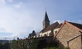
Barnay (French pronunciation: [baʁnɛ]) is a commune in the Saône-et-Loire department in the region of Bourgogne-Franche-Comté in eastern France.[3] It is located north of Autun, close to the border of Côte-d'Or.
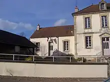
Town hall
Population
| Year | Pop. | ±% p.a. |
|---|---|---|
| 1968 | 169 | — |
| 1975 | 155 | −1.23% |
| 1982 | 124 | −3.14% |
| 1990 | 126 | +0.20% |
| 1999 | 114 | −1.11% |
| 2009 | 101 | −1.20% |
| 2014 | 124 | +4.19% |
| 2020 | 98 | −3.85% |
| Source: INSEE[4] | ||
See also
References
- ↑ "Répertoire national des élus: les maires". data.gouv.fr, Plateforme ouverte des données publiques françaises (in French). 2 December 2020.
- ↑ "Populations légales 2021". The National Institute of Statistics and Economic Studies. 28 December 2023.
- ↑ INSEE commune file
- ↑ Population en historique depuis 1968, INSEE
Wikimedia Commons has media related to Barnay.
This article is issued from Wikipedia. The text is licensed under Creative Commons - Attribution - Sharealike. Additional terms may apply for the media files.