Châtel-Moron | |
|---|---|
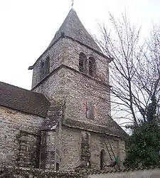 The church in Châtel-Moron | |
Location of Châtel-Moron | |
 Châtel-Moron  Châtel-Moron | |
| Coordinates: 46°47′39″N 4°38′52″E / 46.7942°N 4.6478°E | |
| Country | France |
| Region | Bourgogne-Franche-Comté |
| Department | Saône-et-Loire |
| Arrondissement | Chalon-sur-Saône |
| Canton | Givry |
| Intercommunality | Sud Côte Chalonnaise |
| Area 1 | 6.54 km2 (2.53 sq mi) |
| Population | 86 |
| • Density | 13/km2 (34/sq mi) |
| Time zone | UTC+01:00 (CET) |
| • Summer (DST) | UTC+02:00 (CEST) |
| INSEE/Postal code | 71115 /71510 |
| Elevation | 294–497 m (965–1,631 ft) (avg. 504 m or 1,654 ft) |
| 1 French Land Register data, which excludes lakes, ponds, glaciers > 1 km2 (0.386 sq mi or 247 acres) and river estuaries. | |
Châtel-Moron (French pronunciation: [ʃatɛl mɔʁɔ̃]) is a commune in the Saône-et-Loire department in the region of Bourgogne-Franche-Comté in eastern France.
See also
References
- ↑ "Populations légales 2021". The National Institute of Statistics and Economic Studies. 28 December 2023.
Wikimedia Commons has media related to Châtel-Moron.
This article is issued from Wikipedia. The text is licensed under Creative Commons - Attribution - Sharealike. Additional terms may apply for the media files.