Farges-lès-Macon | |
|---|---|
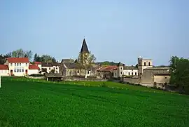 A general view of Farges-lès-Mâcon | |
Location of Farges-lès-Macon | |
 Farges-lès-Macon  Farges-lès-Macon | |
| Coordinates: 46°30′46″N 4°54′01″E / 46.5128°N 4.9003°E | |
| Country | France |
| Region | Bourgogne-Franche-Comté |
| Department | Saône-et-Loire |
| Arrondissement | Mâcon |
| Canton | Tournus |
| Area 1 | 5.73 km2 (2.21 sq mi) |
| Population | 222 |
| • Density | 39/km2 (100/sq mi) |
| Time zone | UTC+01:00 (CET) |
| • Summer (DST) | UTC+02:00 (CEST) |
| INSEE/Postal code | 71195 /71700 |
| Elevation | 168–322 m (551–1,056 ft) (avg. 330 m or 1,080 ft) |
| 1 French Land Register data, which excludes lakes, ponds, glaciers > 1 km2 (0.386 sq mi or 247 acres) and river estuaries. | |
Farges-lès-Mâcon (French pronunciation: [faʁʒ lɛ makɔ̃]) is a commune in the Saône-et-Loire department in the region of Bourgogne-Franche-Comté in eastern France.
See also
References
- ↑ "Populations légales 2021". The National Institute of Statistics and Economic Studies. 28 December 2023.
Wikimedia Commons has media related to Farges-lès-Mâcon.
This article is issued from Wikipedia. The text is licensed under Creative Commons - Attribution - Sharealike. Additional terms may apply for the media files.