Charnay-lès-Mâcon | |
|---|---|
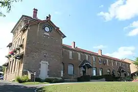 The town hall in Charnay-lès-Mâcon | |
Location of Charnay-lès-Mâcon | |
 Charnay-lès-Mâcon  Charnay-lès-Mâcon | |
| Coordinates: 46°18′32″N 4°47′32″E / 46.309°N 4.7922°E | |
| Country | France |
| Region | Bourgogne-Franche-Comté |
| Department | Saône-et-Loire |
| Arrondissement | Mâcon |
| Canton | Mâcon-1 |
| Intercommunality | Mâconnais Beaujolais Agglomération |
| Government | |
| • Mayor (2020–2026) | Christine Robin[1] |
| Area 1 | 12.56 km2 (4.85 sq mi) |
| Population | 7,969 |
| • Density | 630/km2 (1,600/sq mi) |
| Time zone | UTC+01:00 (CET) |
| • Summer (DST) | UTC+02:00 (CEST) |
| INSEE/Postal code | 71105 /71850 |
| Elevation | 179–310 m (587–1,017 ft) (avg. 196 m or 643 ft) |
| 1 French Land Register data, which excludes lakes, ponds, glaciers > 1 km2 (0.386 sq mi or 247 acres) and river estuaries. | |
Charnay-lès-Mâcon (French pronunciation: [ʃaʁnɛ lɛ makɔ̃], literally Charnay near Mâcon; Arpitan: Chârnê) is a commune in the Saône-et-Loire department in the region of Bourgogne-Franche-Comté in eastern France.
Population
| Year | Pop. | ±% p.a. |
|---|---|---|
| 1968 | 4,603 | — |
| 1975 | 5,058 | +1.36% |
| 1982 | 5,792 | +1.95% |
| 1990 | 6,102 | +0.65% |
| 1999 | 6,739 | +1.11% |
| 2007 | 6,831 | +0.17% |
| 2012 | 6,874 | +0.13% |
| 2017 | 7,376 | +1.42% |
| Source: INSEE[3] | ||
Economy
- Wine production
- Mâcon airport
See also
References
- ↑ "Répertoire national des élus: les maires" (in French). data.gouv.fr, Plateforme ouverte des données publiques françaises. 13 September 2022.
- ↑ "Populations légales 2021". The National Institute of Statistics and Economic Studies. 28 December 2023.
- ↑ Population en historique depuis 1968, INSEE
External links
Wikimedia Commons has media related to Charnay-lès-Mâcon.
This article is issued from Wikipedia. The text is licensed under Creative Commons - Attribution - Sharealike. Additional terms may apply for the media files.