Ferrassières | |
|---|---|
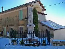 The town hall and the monument to the dead | |
.svg.png.webp) Coat of arms | |
Location of Ferrassières | |
 Ferrassières  Ferrassières | |
| Coordinates: 44°08′11″N 5°28′45″E / 44.1364°N 5.4792°E | |
| Country | France |
| Region | Auvergne-Rhône-Alpes |
| Department | Drôme |
| Arrondissement | Nyons |
| Canton | Nyons et Baronnies |
| Government | |
| • Mayor (2020–2026) | Jean-Pierre Busi[1] |
| Area 1 | 29.27 km2 (11.30 sq mi) |
| Population | 122 |
| • Density | 4.2/km2 (11/sq mi) |
| Time zone | UTC+01:00 (CET) |
| • Summer (DST) | UTC+02:00 (CEST) |
| INSEE/Postal code | 26135 /26570 |
| Elevation | 830–1,389 m (2,723–4,557 ft) |
| 1 French Land Register data, which excludes lakes, ponds, glaciers > 1 km2 (0.386 sq mi or 247 acres) and river estuaries. | |
Ferrassières (French pronunciation: [fɛʁasjɛʁ]; Occitan: Ferrassières) is a commune in the Drôme department in the Auvergne-Rhône-Alpes region in southeastern France.
Population
| Year | Pop. | ±% p.a. |
|---|---|---|
| 1968 | 109 | — |
| 1975 | 118 | +1.14% |
| 1982 | 124 | +0.71% |
| 1990 | 106 | −1.94% |
| 1999 | 113 | +0.71% |
| 2009 | 118 | +0.43% |
| 2014 | 117 | −0.17% |
| 2020 | 122 | +0.70% |
| Source: INSEE[3] | ||
See also
References
- ↑ "Répertoire national des élus: les maires". data.gouv.fr, Plateforme ouverte des données publiques françaises (in French). 9 August 2021.
- ↑ "Populations légales 2021". The National Institute of Statistics and Economic Studies. 28 December 2023.
- ↑ Population en historique depuis 1968, INSEE
Wikimedia Commons has media related to Ferrassières.
This article is issued from Wikipedia. The text is licensed under Creative Commons - Attribution - Sharealike. Additional terms may apply for the media files.