Saint-Vincent-la-Commanderie | |
|---|---|
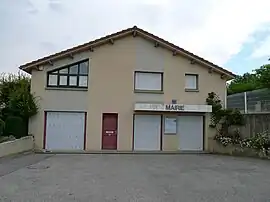 Town hall | |
Location of Saint-Vincent-la-Commanderie | |
 Saint-Vincent-la-Commanderie  Saint-Vincent-la-Commanderie | |
| Coordinates: 44°56′20″N 5°07′08″E / 44.939°N 5.119°E | |
| Country | France |
| Region | Auvergne-Rhône-Alpes |
| Department | Drôme |
| Arrondissement | Valence |
| Canton | Vercors-Monts du Matin |
| Intercommunality | CA Valence Romans Agglo |
| Government | |
| • Mayor (2020–2026) | Françoise Agrain[1] |
| Area 1 | 13.34 km2 (5.15 sq mi) |
| Population | 595 |
| • Density | 45/km2 (120/sq mi) |
| Time zone | UTC+01:00 (CET) |
| • Summer (DST) | UTC+02:00 (CEST) |
| INSEE/Postal code | 26382 /26300 |
| Elevation | 326–1,108 m (1,070–3,635 ft) (avg. 390 m or 1,280 ft) |
| 1 French Land Register data, which excludes lakes, ponds, glaciers > 1 km2 (0.386 sq mi or 247 acres) and river estuaries. | |
Saint-Vincent-la-Commanderie (French pronunciation: [sɛ̃ vɛ̃sɑ̃ la kɔmɑ̃dʁi]; Occitan: Sent Vincenç de Charpei) is a commune in the Drôme department in southeastern France.
Population
| Year | Pop. | ±% p.a. |
|---|---|---|
| 1968 | 236 | — |
| 1975 | 213 | −1.45% |
| 1982 | 229 | +1.04% |
| 1990 | 318 | +4.19% |
| 1999 | 391 | +2.32% |
| 2009 | 414 | +0.57% |
| 2014 | 508 | +4.18% |
| 2020 | 571 | +1.97% |
| Source: INSEE[3] | ||
See also
References
- ↑ "Répertoire national des élus: les maires". data.gouv.fr, Plateforme ouverte des données publiques françaises (in French). 2 December 2020.
- ↑ "Populations légales 2021". The National Institute of Statistics and Economic Studies. 28 December 2023.
- ↑ Population en historique depuis 1968, INSEE
Wikimedia Commons has media related to Saint-Vincent-la-Commanderie.
This article is issued from Wikipedia. The text is licensed under Creative Commons - Attribution - Sharealike. Additional terms may apply for the media files.