Angicourt | |
|---|---|
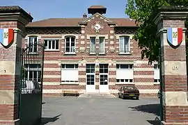 The town hall in Angicourt | |
Location of Angicourt | |
 Angicourt  Angicourt | |
| Coordinates: 49°18′45″N 2°30′16″E / 49.3125°N 2.5044°E | |
| Country | France |
| Region | Hauts-de-France |
| Department | Oise |
| Arrondissement | Clermont |
| Canton | Pont-Sainte-Maxence |
| Intercommunality | CC Pays d'Oise et d'Halatte |
| Government | |
| • Mayor (2020–2026) | Michel Delagrange[1] |
| Area 1 | 4.96 km2 (1.92 sq mi) |
| Population | 1,354 |
| • Density | 270/km2 (710/sq mi) |
| Time zone | UTC+01:00 (CET) |
| • Summer (DST) | UTC+02:00 (CEST) |
| INSEE/Postal code | 60013 /60940 |
| Elevation | 38–120 m (125–394 ft) |
| 1 French Land Register data, which excludes lakes, ponds, glaciers > 1 km2 (0.386 sq mi or 247 acres) and river estuaries. | |
Angicourt (French pronunciation: [ɑ̃ʒikuʁ]) is a commune in the Oise department in northern France.
Population
| Year | Pop. | ±% p.a. |
|---|---|---|
| 1968 | 969 | — |
| 1975 | 1,363 | +4.99% |
| 1982 | 1,495 | +1.33% |
| 1990 | 1,538 | +0.36% |
| 1999 | 1,525 | −0.09% |
| 2009 | 1,603 | +0.50% |
| 2014 | 1,485 | −1.52% |
| 2020 | 1,374 | −1.29% |
| Source: INSEE[3] | ||
See also
References
- ↑ "Répertoire national des élus: les maires". data.gouv.fr, Plateforme ouverte des données publiques françaises (in French). 2 December 2020.
- ↑ "Populations légales 2021". The National Institute of Statistics and Economic Studies. 28 December 2023.
- ↑ Population en historique depuis 1968, INSEE
Wikimedia Commons has media related to Angicourt.
This article is issued from Wikipedia. The text is licensed under Creative Commons - Attribution - Sharealike. Additional terms may apply for the media files.