| Luktvatnet | |
|---|---|
 | |
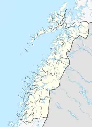 Luktvatnet Location of the lake Show map of Nordland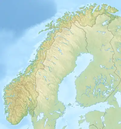 Luktvatnet Luktvatnet (Norway) Show map of Norway | |
| Location | Vefsn, Nordland |
| Coordinates | 66°02′25″N 13°34′39″E / 66.0404°N 13.5776°E / 66.0404; 13.5776 |
| Basin countries | Norway |
| Max. length | 3.4 kilometres (2.1 mi) |
| Max. width | 2 kilometres (1.2 mi) |
| Surface area | 3.76 km2 (1.45 sq mi) |
| Shore length1 | 18.65 kilometres (11.59 mi) |
| Surface elevation | 137 metres (449 ft) |
| References | NVE |
| 1 Shore length is not a well-defined measure. | |
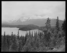
Luktvatnet is a lake that lies in the northern part of the municipality of Vefsn in Nordland county, Norway. The 3.76-square-kilometre (1.45 sq mi) lake lies between the mountains Korgfjellet and Lukttinden, about 5 kilometres (3.1 mi) south of the village of Elsfjord. The European route E6 highway passes along the northern shore of the lake.[1]
Name
The name is probably from the Southern Sami language word Loektejaevrie. This is a compound of loekti which means "inlet" and jaevrie which means "lake", thus it is "the lake with many inlets".
See also
References
- ↑ "Luktvatnet" (in Norwegian). yr.no. Retrieved 2011-11-30.
This article is issued from Wikipedia. The text is licensed under Creative Commons - Attribution - Sharealike. Additional terms may apply for the media files.