Mont-de-Marrast | |
|---|---|
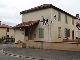 The town hall in Mont-de-Marrast | |
Location of Mont-de-Marrast | |
 Mont-de-Marrast  Mont-de-Marrast | |
| Coordinates: 43°23′01″N 0°21′33″E / 43.38361°N 0.35917°E | |
| Country | France |
| Region | Occitania |
| Department | Gers |
| Arrondissement | Mirande |
| Canton | Mirande-Astarac |
| Government | |
| • Mayor (2020–2026) | Jean-Claude Laborie[1] |
| Area 1 | 7 km2 (3 sq mi) |
| Population | 105 |
| • Density | 15/km2 (39/sq mi) |
| Time zone | UTC+01:00 (CET) |
| • Summer (DST) | UTC+02:00 (CEST) |
| INSEE/Postal code | 32281 /32170 |
| Elevation | 191–304 m (627–997 ft) (avg. 280 m or 920 ft) |
| 1 French Land Register data, which excludes lakes, ponds, glaciers > 1 km2 (0.386 sq mi or 247 acres) and river estuaries. | |
Mont-de-Marrast is a commune in the Gers department in southwestern France.
Geography
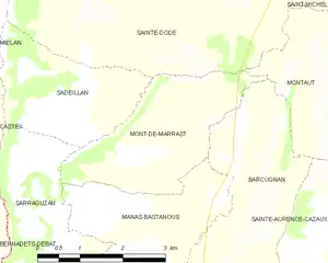
Mont-de-Marrast and its surrounding communes
Population
| Year | Pop. | ±% |
|---|---|---|
| 1962 | 173 | — |
| 1968 | 149 | −13.9% |
| 1975 | 121 | −18.8% |
| 1982 | 100 | −17.4% |
| 1990 | 100 | +0.0% |
| 1999 | 102 | +2.0% |
| 2008 | 96 | −5.9% |
See also
References
- ↑ "Répertoire national des élus: les maires". data.gouv.fr, Plateforme ouverte des données publiques françaises (in French). 2 December 2020.
- ↑ "Populations légales 2021". The National Institute of Statistics and Economic Studies. 28 December 2023.
Wikimedia Commons has media related to Mont-de-Marrast.
This article is issued from Wikipedia. The text is licensed under Creative Commons - Attribution - Sharealike. Additional terms may apply for the media files.