Sempesserre | |
|---|---|
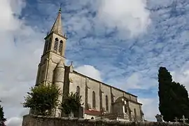 The church in Sempesserre | |
Location of Sempesserre | |
 Sempesserre  Sempesserre | |
| Coordinates: 44°01′00″N 0°39′00″E / 44.0167°N 0.65°E | |
| Country | France |
| Region | Occitania |
| Department | Gers |
| Arrondissement | Condom |
| Canton | Lectoure-Lomagne |
| Intercommunality | Lomagne Gersoise |
| Government | |
| • Mayor (2020–2026) | Philippe Blancquart[1] |
| Area 1 | 20.99 km2 (8.10 sq mi) |
| Population | 304 |
| • Density | 14/km2 (38/sq mi) |
| Time zone | UTC+01:00 (CET) |
| • Summer (DST) | UTC+02:00 (CEST) |
| INSEE/Postal code | 32429 /32700 |
| Elevation | 57–210 m (187–689 ft) (avg. 160 m or 520 ft) |
| 1 French Land Register data, which excludes lakes, ponds, glaciers > 1 km2 (0.386 sq mi or 247 acres) and river estuaries. | |
Sempesserre (French pronunciation: [sɑ̃pesɛʁ]; Languedocien: Sempessèrra) is a commune in the Gers department in southwestern France.
Geography
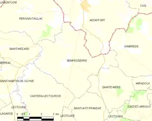
Sempesserre and its surrounding communes
Population
| Year | Pop. | ±% p.a. |
|---|---|---|
| 1968 | 355 | — |
| 1975 | 303 | −2.24% |
| 1982 | 296 | −0.33% |
| 1990 | 303 | +0.29% |
| 1999 | 311 | +0.29% |
| 2007 | 296 | −0.62% |
| 2012 | 314 | +1.19% |
| 2017 | 294 | −1.31% |
| Source: INSEE[3] | ||
See also
References
- ↑ "Répertoire national des élus: les maires" (in French). data.gouv.fr, Plateforme ouverte des données publiques françaises. 13 September 2022.
- ↑ "Populations légales 2021". The National Institute of Statistics and Economic Studies. 28 December 2023.
- ↑ Population en historique depuis 1968, INSEE
Wikimedia Commons has media related to Sempesserre.
This article is issued from Wikipedia. The text is licensed under Creative Commons - Attribution - Sharealike. Additional terms may apply for the media files.