Biol | |
|---|---|
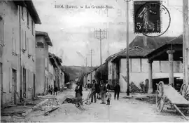 The main road in 1908 | |
Location of Biol | |
 Biol  Biol | |
| Coordinates: 45°29′33″N 5°23′10″E / 45.4925°N 5.3861°E | |
| Country | France |
| Region | Auvergne-Rhône-Alpes |
| Department | Isère |
| Arrondissement | La Tour-du-Pin |
| Canton | Le Grand-Lemps |
| Government | |
| • Mayor (2020–2026) | Patrick Belmont[1] |
| Area 1 | 15.51 km2 (5.99 sq mi) |
| Population | 1,520 |
| • Density | 98/km2 (250/sq mi) |
| Time zone | UTC+01:00 (CET) |
| • Summer (DST) | UTC+02:00 (CEST) |
| INSEE/Postal code | 38044 /38690 |
| Elevation | 438–691 m (1,437–2,267 ft) |
| 1 French Land Register data, which excludes lakes, ponds, glaciers > 1 km2 (0.386 sq mi or 247 acres) and river estuaries. | |
Biol (French pronunciation: [bjɔl]) is a commune in the Isère department in southeastern France.
Population
| Year | Pop. | ±% p.a. |
|---|---|---|
| 1968 | 810 | — |
| 1975 | 774 | −0.65% |
| 1982 | 972 | +3.31% |
| 1990 | 1,025 | +0.67% |
| 1999 | 1,203 | +1.80% |
| 2007 | 1,311 | +1.08% |
| 2012 | 1,410 | +1.47% |
| 2017 | 1,419 | +0.13% |
| Source: INSEE[3] | ||
See also
References
- ↑ "Répertoire national des élus: les maires". data.gouv.fr, Plateforme ouverte des données publiques françaises (in French). 2 December 2020.
- ↑ "Populations légales 2021". The National Institute of Statistics and Economic Studies. 28 December 2023.
- ↑ Population en historique depuis 1968, INSEE
Wikimedia Commons has media related to Biol.
This article is issued from Wikipedia. The text is licensed under Creative Commons - Attribution - Sharealike. Additional terms may apply for the media files.