Oytier-Saint Oblas | |
|---|---|
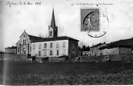 Oytier in 1907 | |
 Coat of arms | |
Location of Oytier-Saint Oblas | |
 Oytier-Saint Oblas  Oytier-Saint Oblas | |
| Coordinates: 45°33′42″N 5°01′18″E / 45.5617°N 5.0217°E | |
| Country | France |
| Region | Auvergne-Rhône-Alpes |
| Department | Isère |
| Arrondissement | Vienne |
| Canton | La Verpillière |
| Intercommunality | Collines du Nord Dauphiné |
| Government | |
| • Mayor (2020–2026) | René Poretta[1] |
| Area 1 | 14.3 km2 (5.5 sq mi) |
| Population | 1,720 |
| • Density | 120/km2 (310/sq mi) |
| Time zone | UTC+01:00 (CET) |
| • Summer (DST) | UTC+02:00 (CEST) |
| INSEE/Postal code | 38288 /38780 |
| Elevation | 232–376 m (761–1,234 ft) (avg. 236 m or 774 ft) |
| 1 French Land Register data, which excludes lakes, ponds, glaciers > 1 km2 (0.386 sq mi or 247 acres) and river estuaries. | |
Oytier-Saint-Oblas is a commune in the Isère department in southeastern France.[3]
Population
| Year | Pop. | ±% p.a. |
|---|---|---|
| 1968 | 550 | — |
| 1975 | 558 | +0.21% |
| 1982 | 686 | +2.99% |
| 1990 | 1,022 | +5.11% |
| 1999 | 1,353 | +3.17% |
| 2009 | 1,559 | +1.43% |
| 2014 | 1,619 | +0.76% |
| 2020 | 1,684 | +0.66% |
| Source: INSEE[4] | ||
See also
References
- ↑ "Répertoire national des élus: les maires". data.gouv.fr, Plateforme ouverte des données publiques françaises (in French). 2 December 2020.
- ↑ "Populations légales 2021". The National Institute of Statistics and Economic Studies. 28 December 2023.
- ↑ INSEE commune file
- ↑ Population en historique depuis 1968, INSEE
Wikimedia Commons has media related to Oytier-Saint-Oblas.
This article is issued from Wikipedia. The text is licensed under Creative Commons - Attribution - Sharealike. Additional terms may apply for the media files.