Sarcenas | |
|---|---|
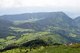 A general view of Sarcenas | |
Location of Sarcenas | |
 Sarcenas  Sarcenas | |
| Coordinates: 45°16′29″N 5°45′31″E / 45.2747°N 5.7586°E | |
| Country | France |
| Region | Auvergne-Rhône-Alpes |
| Department | Isère |
| Arrondissement | Grenoble |
| Canton | Grenoble-2 |
| Intercommunality | Grenoble-Alpes Métropole |
| Government | |
| • Mayor (2020–2026) | Sylvain Duloutre[1] |
| Area 1 | 8 km2 (3 sq mi) |
| Population | 242 |
| • Density | 30/km2 (78/sq mi) |
| Time zone | UTC+01:00 (CET) |
| • Summer (DST) | UTC+02:00 (CEST) |
| INSEE/Postal code | 38472 /38700 |
| Elevation | 892–2,079 m (2,927–6,821 ft) (avg. 1,100 m or 3,600 ft) |
| 1 French Land Register data, which excludes lakes, ponds, glaciers > 1 km2 (0.386 sq mi or 247 acres) and river estuaries. | |
Sarcenas is a commune in the Isère department in southeastern France.[3]
Population
| Year | Pop. | ±% p.a. |
|---|---|---|
| 1968 | 80 | — |
| 1975 | 90 | +1.70% |
| 1982 | 98 | +1.22% |
| 1990 | 128 | +3.39% |
| 1999 | 141 | +1.08% |
| 2009 | 194 | +3.24% |
| 2014 | 197 | +0.31% |
| 2020 | 227 | +2.39% |
| Source: INSEE[4] | ||
See also
References
- ↑ "Répertoire national des élus: les maires". data.gouv.fr, Plateforme ouverte des données publiques françaises (in French). 2 December 2020.
- ↑ "Populations légales 2021". The National Institute of Statistics and Economic Studies. 28 December 2023.
- ↑ INSEE commune file
- ↑ Population en historique depuis 1968, INSEE
Wikimedia Commons has media related to Sarcenas.
This article is issued from Wikipedia. The text is licensed under Creative Commons - Attribution - Sharealike. Additional terms may apply for the media files.