Champier | |
|---|---|
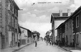 The main road in 1922 | |
Location of Champier | |
 Champier  Champier | |
| Coordinates: 45°27′15″N 5°17′30″E / 45.4542°N 5.2917°E | |
| Country | France |
| Region | Auvergne-Rhône-Alpes |
| Department | Isère |
| Arrondissement | Vienne |
| Canton | Bièvre |
| Government | |
| • Mayor (2020–2026) | Sébastien Laroche[1] |
| Area 1 | 14.43 km2 (5.57 sq mi) |
| Population | 1,510 |
| • Density | 100/km2 (270/sq mi) |
| Time zone | UTC+01:00 (CET) |
| • Summer (DST) | UTC+02:00 (CEST) |
| INSEE/Postal code | 38069 /38260 |
| Elevation | 470–631 m (1,542–2,070 ft) (avg. 507 m or 1,663 ft) |
| 1 French Land Register data, which excludes lakes, ponds, glaciers > 1 km2 (0.386 sq mi or 247 acres) and river estuaries. | |
Champier (French pronunciation: [ʃɑ̃pje]) is a commune in the Isère department in southeastern France.[3]
Population
| Year | Pop. | ±% p.a. |
|---|---|---|
| 1968 | 741 | — |
| 1975 | 757 | +0.31% |
| 1982 | 832 | +1.36% |
| 1990 | 873 | +0.60% |
| 1999 | 967 | +1.14% |
| 2007 | 1,120 | +1.85% |
| 2012 | 1,302 | +3.06% |
| 2017 | 1,400 | +1.46% |
| Source: INSEE[4] | ||
See also
References
- ↑ "Répertoire national des élus: les maires" (in French). data.gouv.fr, Plateforme ouverte des données publiques françaises. 13 September 2022.
- ↑ "Populations légales 2021". The National Institute of Statistics and Economic Studies. 28 December 2023.
- ↑ INSEE commune file
- ↑ Population en historique depuis 1968, INSEE
Wikimedia Commons has media related to Champier.
This article is issued from Wikipedia. The text is licensed under Creative Commons - Attribution - Sharealike. Additional terms may apply for the media files.