Moras | |
|---|---|
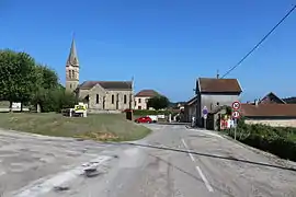 The church of Moras and its surroundings | |
Location of Moras | |
 Moras  Moras | |
| Coordinates: 45°41′18″N 5°15′32″E / 45.6883°N 5.2589°E | |
| Country | France |
| Region | Auvergne-Rhône-Alpes |
| Department | Isère |
| Arrondissement | La Tour-du-Pin |
| Canton | Charvieu-Chavagneux |
| Government | |
| • Mayor (2022–2026) | Sylvie Bogas[1] |
| Area 1 | 8.32 km2 (3.21 sq mi) |
| Population | 525 |
| • Density | 63/km2 (160/sq mi) |
| Time zone | UTC+01:00 (CET) |
| • Summer (DST) | UTC+02:00 (CEST) |
| INSEE/Postal code | 38260 /38460 |
| Elevation | 275–436 m (902–1,430 ft) (avg. 345 m or 1,132 ft) |
| 1 French Land Register data, which excludes lakes, ponds, glaciers > 1 km2 (0.386 sq mi or 247 acres) and river estuaries. | |
Moras is a commune in the Isère department in southeastern France.[3]
Population
| Year | Pop. | ±% p.a. |
|---|---|---|
| 1968 | 167 | — |
| 1975 | 188 | +1.71% |
| 1982 | 359 | +9.68% |
| 1990 | 339 | −0.71% |
| 1999 | 418 | +2.35% |
| 2009 | 468 | +1.14% |
| 2014 | 506 | +1.57% |
| 2020 | 523 | +0.55% |
| Source: INSEE[4] | ||
See also
References
- ↑ "Répertoire national des élus: les maires" (in French). data.gouv.fr, Plateforme ouverte des données publiques françaises. 4 May 2022.
- ↑ "Populations légales 2021". The National Institute of Statistics and Economic Studies. 28 December 2023.
- ↑ INSEE commune file
- ↑ Population en historique depuis 1968, INSEE
Wikimedia Commons has media related to Moras.
This article is issued from Wikipedia. The text is licensed under Creative Commons - Attribution - Sharealike. Additional terms may apply for the media files.