Plan | |
|---|---|
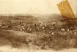 Plan at the start of the 20th century | |
Location of Plan | |
 Plan  Plan | |
| Coordinates: 45°18′49″N 5°23′36″E / 45.3136°N 5.3933°E | |
| Country | France |
| Region | Auvergne-Rhône-Alpes |
| Department | Isère |
| Arrondissement | Vienne |
| Canton | Bièvre |
| Government | |
| • Mayor (2020–2026) | Patrick Cugniet[1] |
| Area 1 | 6.1 km2 (2.4 sq mi) |
| Population | 292 |
| • Density | 48/km2 (120/sq mi) |
| Time zone | UTC+01:00 (CET) |
| • Summer (DST) | UTC+02:00 (CEST) |
| INSEE/Postal code | 38308 /38590 |
| Elevation | 452–785 m (1,483–2,575 ft) (avg. 600 m or 2,000 ft) |
| 1 French Land Register data, which excludes lakes, ponds, glaciers > 1 km2 (0.386 sq mi or 247 acres) and river estuaries. | |
Plan (French pronunciation: [plɑ̃] ⓘ) is a commune in the Isère department in southeastern France.[3]
Population
| Year | Pop. | ±% p.a. |
|---|---|---|
| 1968 | 125 | — |
| 1975 | 113 | −1.43% |
| 1982 | 147 | +3.83% |
| 1990 | 184 | +2.85% |
| 1999 | 182 | −0.12% |
| 2009 | 234 | +2.54% |
| 2014 | 252 | +1.49% |
| 2020 | 279 | +1.71% |
| Source: INSEE[4] | ||
See also
References
Wikimedia Commons has media related to Plan (Isère).
- ↑ "Répertoire national des élus: les maires" (in French). data.gouv.fr, Plateforme ouverte des données publiques françaises. 13 September 2022.
- ↑ "Populations légales 2021". The National Institute of Statistics and Economic Studies. 28 December 2023.
- ↑ INSEE commune file
- ↑ Population en historique depuis 1968, INSEE
This article is issued from Wikipedia. The text is licensed under Creative Commons - Attribution - Sharealike. Additional terms may apply for the media files.