Tejupá | |
|---|---|
 | |
 Coat of arms | |
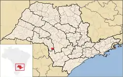 Location in São Paulo state | |
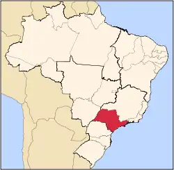
 Tejupá Location in Brazil | |
| Coordinates: 23°20′34″S 49°22′33″W / 23.34278°S 49.37583°W | |
| Country | Brazil |
| Region | Southeast |
| State | São Paulo |
| Area | |
| • Total | 296 km2 (114 sq mi) |
| Population (2020 [1]) | |
| • Total | 4,491 |
| • Density | 15/km2 (39/sq mi) |
| Time zone | UTC−3 (BRT) |
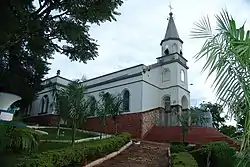
Tejupá is a municipality in the state of São Paulo in Brazil. The population is 4,491 (2020 estimate) in an area of 296 km².[2] The elevation is 765 m.
References
Capital: São Paulo | |||||||||||||||||||||
|  | ||||||||||||||||||||
|
| |||||||||||||||||||||
| |||||||||||||||||||||
| |||||||||||||||||||||
| |||||||||||||||||||||
| |||||||||||||||||||||
| |||||||||||||||||||||
| |||||||||||||||||||||
| |||||||||||||||||||||
| |||||||||||||||||||||
| |||||||||||||||||||||
| |||||||||||||||||||||
| |||||||||||||||||||||
This article is issued from Wikipedia. The text is licensed under Creative Commons - Attribution - Sharealike. Additional terms may apply for the media files.