Briquemesnil-Floxicourt | |
|---|---|
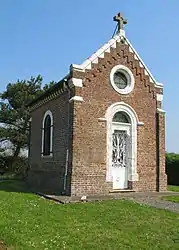 The chapel by the cemetery in Briquemesnil | |
Location of Briquemesnil-Floxicourt | |
 Briquemesnil-Floxicourt  Briquemesnil-Floxicourt | |
| Coordinates: 49°53′07″N 2°05′14″E / 49.8853°N 2.0872°E | |
| Country | France |
| Region | Hauts-de-France |
| Department | Somme |
| Arrondissement | Amiens |
| Canton | Ailly-sur-Somme |
| Intercommunality | CC Somme Sud-Ouest |
| Government | |
| • Mayor (2020–2026) | Jean-Jacques Stoter[1] |
| Area 1 | 7.35 km2 (2.84 sq mi) |
| Population | 344 |
| • Density | 47/km2 (120/sq mi) |
| Time zone | UTC+01:00 (CET) |
| • Summer (DST) | UTC+02:00 (CEST) |
| INSEE/Postal code | 80142 /80540 |
| Elevation | 53–126 m (174–413 ft) (avg. 115 m or 377 ft) |
| 1 French Land Register data, which excludes lakes, ponds, glaciers > 1 km2 (0.386 sq mi or 247 acres) and river estuaries. | |
Briquemesnil-Floxicourt (French pronunciation: [bʁikmenil flɔksikuʁ]; Picard: Bricmangni-Tchot Flichcourt) is a commune in the Somme department in Hauts-de-France in northern France.
Geography
The communes is situated on the D211 road, some 15 miles (24 km) west of Amiens.
Population
| Year | Pop. | ±% p.a. |
|---|---|---|
| 1968 | 136 | — |
| 1975 | 143 | +0.72% |
| 1982 | 173 | +2.76% |
| 1990 | 182 | +0.64% |
| 1999 | 153 | −1.91% |
| 2007 | 159 | +0.48% |
| 2012 | 181 | +2.63% |
| 2017 | 269 | +8.25% |
| Source: INSEE[3] | ||
See also
References
- ↑ "Répertoire national des élus: les maires". data.gouv.fr, Plateforme ouverte des données publiques françaises (in French). 2 December 2020.
- ↑ "Populations légales 2021". The National Institute of Statistics and Economic Studies. 28 December 2023.
- ↑ Population en historique depuis 1968, INSEE
Wikimedia Commons has media related to Briquemesnil-Floxicourt.
This article is issued from Wikipedia. The text is licensed under Creative Commons - Attribution - Sharealike. Additional terms may apply for the media files.