Hervilly | |
|---|---|
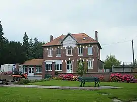 The town hall and school in Hervilly | |
Location of Hervilly | |
 Hervilly  Hervilly | |
| Coordinates: 49°56′12″N 3°07′01″E / 49.9367°N 3.1169°E | |
| Country | France |
| Region | Hauts-de-France |
| Department | Somme |
| Arrondissement | Péronne |
| Canton | Péronne |
| Intercommunality | Haute Somme |
| Government | |
| • Mayor (2020–2026) | Gaëtan Dodré[1] |
| Area 1 | 6.18 km2 (2.39 sq mi) |
| Population | 190 |
| • Density | 31/km2 (80/sq mi) |
| Time zone | UTC+01:00 (CET) |
| • Summer (DST) | UTC+02:00 (CEST) |
| INSEE/Postal code | 80434 /80240 |
| Elevation | 72–133 m (236–436 ft) (avg. 75 m or 246 ft) |
| 1 French Land Register data, which excludes lakes, ponds, glaciers > 1 km2 (0.386 sq mi or 247 acres) and river estuaries. | |
Hervilly is a commune in the Somme department in Hauts-de-France in northern France.
Geography
Hervilly is situated on the D24 road, some 13 miles (21 km) northwest of Saint-Quentin.
Population
| Year | Pop. | ±% p.a. |
|---|---|---|
| 1968 | 174 | — |
| 1975 | 165 | −0.76% |
| 1982 | 184 | +1.57% |
| 1990 | 197 | +0.86% |
| 1999 | 204 | +0.39% |
| 2007 | 189 | −0.95% |
| 2012 | 165 | −2.68% |
| 2017 | 189 | +2.75% |
| Source: INSEE[3] | ||
See also
References
- ↑ "Répertoire national des élus: les maires". data.gouv.fr, Plateforme ouverte des données publiques françaises (in French). 2 December 2020.
- ↑ "Populations légales 2021". The National Institute of Statistics and Economic Studies. 28 December 2023.
- ↑ Population en historique depuis 1968, INSEE
Wikimedia Commons has media related to Hervilly.
This article is issued from Wikipedia. The text is licensed under Creative Commons - Attribution - Sharealike. Additional terms may apply for the media files.