Monchy-Lagache | |
|---|---|
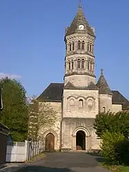 The church in Monchy-Lagache | |
 Coat of arms | |
Location of Monchy-Lagache | |
 Monchy-Lagache  Monchy-Lagache | |
| Coordinates: 49°51′09″N 3°02′43″E / 49.8525°N 3.0453°E | |
| Country | France |
| Region | Hauts-de-France |
| Department | Somme |
| Arrondissement | Péronne |
| Canton | Ham |
| Intercommunality | CC Est de la Somme |
| Government | |
| • Mayor (2020–2026) | Jacques Pinchon[1] |
| Area 1 | 15.44 km2 (5.96 sq mi) |
| Population | 583 |
| • Density | 38/km2 (98/sq mi) |
| Time zone | UTC+01:00 (CET) |
| • Summer (DST) | UTC+02:00 (CEST) |
| INSEE/Postal code | 80555 /80200 |
| Elevation | 57–95 m (187–312 ft) (avg. 74 m or 243 ft) |
| 1 French Land Register data, which excludes lakes, ponds, glaciers > 1 km2 (0.386 sq mi or 247 acres) and river estuaries. | |
Monchy-Lagache (French pronunciation: [mɔ̃ʃi laɡaʃ]) is a commune in the Somme department in Hauts-de-France in northern France.
Geography
The commune is situated on the D15 road, some 10 miles (16 km) west of Saint-Quentin, on the northeastern border of the département.
Population
| Year | Pop. | ±% p.a. |
|---|---|---|
| 1968 | 651 | — |
| 1975 | 752 | +2.08% |
| 1982 | 810 | +1.07% |
| 1990 | 785 | −0.39% |
| 1999 | 740 | −0.65% |
| 2007 | 733 | −0.12% |
| 2012 | 673 | −1.69% |
| 2017 | 643 | −0.91% |
| Source: INSEE[3] | ||
See also
References
- ↑ "Répertoire national des élus: les maires" (in French). data.gouv.fr, Plateforme ouverte des données publiques françaises. 13 September 2022.
- ↑ "Populations légales 2021". The National Institute of Statistics and Economic Studies. 28 December 2023.
- ↑ Population en historique depuis 1968, INSEE
External links
Wikimedia Commons has media related to Monchy-Lagache.
- Statistical data, INSEE
This article is issued from Wikipedia. The text is licensed under Creative Commons - Attribution - Sharealike. Additional terms may apply for the media files.