Dompierre-Becquincourt | |
|---|---|
.JPG.webp) The church in Dompierre-Becquincourt | |
Location of Dompierre-Becquincourt | |
 Dompierre-Becquincourt  Dompierre-Becquincourt | |
| Coordinates: 49°54′29″N 2°48′21″E / 49.9081°N 2.8058°E | |
| Country | France |
| Region | Hauts-de-France |
| Department | Somme |
| Arrondissement | Péronne |
| Canton | Ham |
| Intercommunality | CC Terre de Picardie |
| Government | |
| • Mayor (2020–2026) | Jean-Luc Maillard[1] |
| Area 1 | 11.05 km2 (4.27 sq mi) |
| Population | 719 |
| • Density | 65/km2 (170/sq mi) |
| Time zone | UTC+01:00 (CET) |
| • Summer (DST) | UTC+02:00 (CEST) |
| INSEE/Postal code | 80247 /80980 |
| Elevation | 54–92 m (177–302 ft) (avg. 100 m or 330 ft) |
| 1 French Land Register data, which excludes lakes, ponds, glaciers > 1 km2 (0.386 sq mi or 247 acres) and river estuaries. | |
Dompierre-Becquincourt (French pronunciation: [dɔ̃pjɛʁ bɛkɛ̃kuʁ]) is a commune in the Somme department in Hauts-de-France in northern France.
Geography
The commune is situated on the D71 road, some 30 miles (48 km) east of Amiens.
Population
| Year | Pop. | ±% p.a. |
|---|---|---|
| 1968 | 703 | — |
| 1975 | 635 | −1.44% |
| 1982 | 646 | +0.25% |
| 1990 | 664 | +0.34% |
| 1999 | 642 | −0.37% |
| 2007 | 630 | −0.24% |
| 2012 | 671 | +1.27% |
| 2017 | 706 | +1.02% |
| Source: INSEE[3] | ||
Gallery
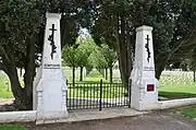 French World War I cemetery
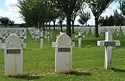 French World War I cemetery
See also
References
- ↑ "Répertoire national des élus: les maires". data.gouv.fr, Plateforme ouverte des données publiques françaises (in French). 2 December 2020.
- ↑ "Populations légales 2021". The National Institute of Statistics and Economic Studies. 28 December 2023.
- ↑ Population en historique depuis 1968, INSEE
Wikimedia Commons has media related to Dompierre-Becquincourt.
This article is issued from Wikipedia. The text is licensed under Creative Commons - Attribution - Sharealike. Additional terms may apply for the media files.