Ignaucourt | |
|---|---|
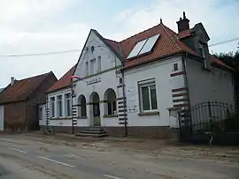 The town hall in Ignaucourt | |
Location of Ignaucourt | |
 Ignaucourt  Ignaucourt | |
| Coordinates: 49°49′36″N 2°34′28″E / 49.8267°N 2.5744°E | |
| Country | France |
| Region | Hauts-de-France |
| Department | Somme |
| Arrondissement | Montdidier |
| Canton | Moreuil |
| Intercommunality | Avre Luce Noye |
| Government | |
| • Mayor (2020–2026) | Pascal Berthe[1] |
| Area 1 | 4.19 km2 (1.62 sq mi) |
| Population | 65 |
| • Density | 16/km2 (40/sq mi) |
| Time zone | UTC+01:00 (CET) |
| • Summer (DST) | UTC+02:00 (CEST) |
| INSEE/Postal code | 80449 /80800 |
| Elevation | 46–99 m (151–325 ft) (avg. 40 m or 130 ft) |
| 1 French Land Register data, which excludes lakes, ponds, glaciers > 1 km2 (0.386 sq mi or 247 acres) and river estuaries. | |
Ignaucourt (French pronunciation: [iɲokuʁ]) is a commune in the Somme department in Hauts-de-France in northern France.
Geography
Ignaucourt is situated on the D76 road, some 15 miles (24 km) southeast of Amiens.
Population
| Year | Pop. | ±% p.a. |
|---|---|---|
| 1968 | 79 | — |
| 1975 | 81 | +0.36% |
| 1982 | 64 | −3.31% |
| 1990 | 63 | −0.20% |
| 1999 | 82 | +2.97% |
| 2007 | 75 | −1.11% |
| 2012 | 91 | +3.94% |
| 2017 | 76 | −3.54% |
| Source: INSEE[3] | ||
See also
References
- ↑ "Répertoire national des élus: les maires". data.gouv.fr, Plateforme ouverte des données publiques françaises (in French). 9 August 2021.
- ↑ "Populations légales 2021". The National Institute of Statistics and Economic Studies. 28 December 2023.
- ↑ Population en historique depuis 1968, INSEE
Wikimedia Commons has media related to Ignaucourt.
This article is issued from Wikipedia. The text is licensed under Creative Commons - Attribution - Sharealike. Additional terms may apply for the media files.