Machiel | |
|---|---|
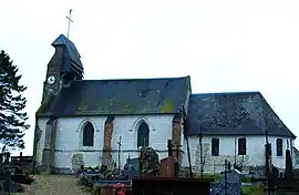 The church in Machiel | |
Location of Machiel | |
 Machiel  Machiel | |
| Coordinates: 50°16′01″N 1°49′59″E / 50.267°N 1.833°E | |
| Country | France |
| Region | Hauts-de-France |
| Department | Somme |
| Arrondissement | Abbeville |
| Canton | Rue |
| Intercommunality | Ponthieu-Marquenterre |
| Government | |
| • Mayor (2020–2026) | Olivier Pley[1] |
| Area 1 | 6.61 km2 (2.55 sq mi) |
| Population | 152 |
| • Density | 23/km2 (60/sq mi) |
| Time zone | UTC+01:00 (CET) |
| • Summer (DST) | UTC+02:00 (CEST) |
| INSEE/Postal code | 80496 /80150 |
| Elevation | 17–76 m (56–249 ft) (avg. 24 m or 79 ft) |
| 1 French Land Register data, which excludes lakes, ponds, glaciers > 1 km2 (0.386 sq mi or 247 acres) and river estuaries. | |
Machiel is a commune in the Somme department in Hauts-de-France in northern France.
Geography
Machiel is situated on the D938 road, some 10 miles (16 km) north of Abbeville, in the forest of Crécy.
Population
| Year | Pop. | ±% p.a. |
|---|---|---|
| 1968 | 175 | — |
| 1975 | 173 | −0.16% |
| 1982 | 169 | −0.33% |
| 1990 | 177 | +0.58% |
| 1999 | 171 | −0.38% |
| 2007 | 160 | −0.83% |
| 2012 | 177 | +2.04% |
| 2017 | 156 | −2.49% |
| Source: INSEE[3] | ||
Monument aux morts
The Machiel monument aux morts features a sculpture by Albert-Dominique Roze. A montage of photographs of this monument aux morts is shown below.
See also
References
- ↑ "Répertoire national des élus: les maires" (in French). data.gouv.fr, Plateforme ouverte des données publiques françaises. 13 September 2022.
- ↑ "Populations légales 2021". The National Institute of Statistics and Economic Studies. 28 December 2023.
- ↑ Population en historique depuis 1968, INSEE
Wikimedia Commons has media related to Machiel.
This article is issued from Wikipedia. The text is licensed under Creative Commons - Attribution - Sharealike. Additional terms may apply for the media files.