Hautvillers-Ouville | |
|---|---|
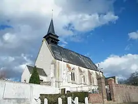 Church | |
Location of Hautvillers-Ouville | |
 Hautvillers-Ouville  Hautvillers-Ouville | |
| Coordinates: 50°10′24″N 1°48′57″E / 50.1733°N 1.8158°E | |
| Country | France |
| Region | Hauts-de-France |
| Department | Somme |
| Arrondissement | Abbeville |
| Canton | Abbeville-1 |
| Intercommunality | CC Ponthieu-Marquenterre |
| Government | |
| • Mayor (2020–2026) | Frédéric Noël[1] |
| Area 1 | 6.06 km2 (2.34 sq mi) |
| Population | 558 |
| • Density | 92/km2 (240/sq mi) |
| Time zone | UTC+01:00 (CET) |
| • Summer (DST) | UTC+02:00 (CEST) |
| INSEE/Postal code | 80422 /80132 |
| Elevation | 44–68 m (144–223 ft) (avg. 59 m or 194 ft) |
| 1 French Land Register data, which excludes lakes, ponds, glaciers > 1 km2 (0.386 sq mi or 247 acres) and river estuaries. | |
Hautvillers-Ouville is a commune in the Somme department in Hauts-de-France in northern France.
Geography
The commune is situated on the N1 road, 8 kilometres (5 mi) north of Abbeville.
Population
| Year | Pop. | ±% p.a. |
|---|---|---|
| 1968 | 346 | — |
| 1975 | 383 | +1.46% |
| 1982 | 396 | +0.48% |
| 1990 | 401 | +0.16% |
| 1999 | 378 | −0.65% |
| 2007 | 435 | +1.77% |
| 2012 | 584 | +6.07% |
| 2017 | 580 | −0.14% |
| Source: INSEE[3] | ||
See also
References
- ↑ "Répertoire national des élus: les maires" (in French). data.gouv.fr, Plateforme ouverte des données publiques françaises. 13 September 2022.
- ↑ "Populations légales 2021". The National Institute of Statistics and Economic Studies. 28 December 2023.
- ↑ Population en historique depuis 1968, INSEE
Wikimedia Commons has media related to Hautvillers-Ouville.
This article is issued from Wikipedia. The text is licensed under Creative Commons - Attribution - Sharealike. Additional terms may apply for the media files.