Pierregot | |
|---|---|
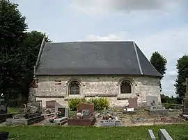 The chapel of Notre-Dame O Pie, in Pierregot | |
Location of Pierregot | |
 Pierregot  Pierregot | |
| Coordinates: 50°00′09″N 2°22′49″E / 50.0025°N 2.3803°E | |
| Country | France |
| Region | Hauts-de-France |
| Department | Somme |
| Arrondissement | Amiens |
| Canton | Corbie |
| Intercommunality | CC Territoire Nord Picardie |
| Government | |
| • Mayor (2020–2026) | Loïc Dupont[1] |
| Area 1 | 2.46 km2 (0.95 sq mi) |
| Population | 285 |
| • Density | 120/km2 (300/sq mi) |
| Time zone | UTC+01:00 (CET) |
| • Summer (DST) | UTC+02:00 (CEST) |
| INSEE/Postal code | 80624 /80260 |
| Elevation | 95–134 m (312–440 ft) (avg. 118 m or 387 ft) |
| 1 French Land Register data, which excludes lakes, ponds, glaciers > 1 km2 (0.386 sq mi or 247 acres) and river estuaries. | |
Pierregot (French pronunciation: [pjɛʁɡo]; Pièrgou in Picard) is a commune in the Somme department in Hauts-de-France in northern France.
Geography
Pierregot is situated on the D11 road, some 10 miles (16 km) northeast of Amiens.
Mayors
- Daniel Sauvet (2008–2014)
- Gérard Philippe (2001–2008)
Population
| Year | Pop. | ±% p.a. |
|---|---|---|
| 1968 | 179 | — |
| 1975 | 180 | +0.08% |
| 1982 | 211 | +2.30% |
| 1990 | 250 | +2.14% |
| 1999 | 243 | −0.32% |
| 2007 | 249 | +0.31% |
| 2012 | 257 | +0.63% |
| 2017 | 280 | +1.73% |
| Source: INSEE[3] | ||
See also
References
- ↑ "Répertoire national des élus: les maires". data.gouv.fr, Plateforme ouverte des données publiques françaises (in French). 2 December 2020.
- ↑ "Populations légales 2021". The National Institute of Statistics and Economic Studies. 28 December 2023.
- ↑ Population en historique depuis 1968, INSEE
Wikimedia Commons has media related to Pierregot.
This article is issued from Wikipedia. The text is licensed under Creative Commons - Attribution - Sharealike. Additional terms may apply for the media files.