Beugin
Belgin | |
|---|---|
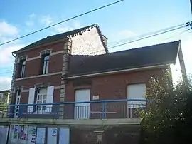 The town hall of Beugin | |
 Coat of arms | |
Location of Beugin | |
 Beugin  Beugin | |
| Coordinates: 50°26′34″N 2°31′06″E / 50.4428°N 2.5183°E | |
| Country | France |
| Region | Hauts-de-France |
| Department | Pas-de-Calais |
| Arrondissement | Béthune |
| Canton | Bruay-la-Buissière |
| Intercommunality | CA Béthune-Bruay, Artois-Lys Romane |
| Government | |
| • Mayor (2020–2026) | Odile Leclercq[1] |
| Area 1 | 5.06 km2 (1.95 sq mi) |
| Population | 464 |
| • Density | 92/km2 (240/sq mi) |
| Time zone | UTC+01:00 (CET) |
| • Summer (DST) | UTC+02:00 (CEST) |
| INSEE/Postal code | 62120 /62150 |
| Elevation | 55–147 m (180–482 ft) (avg. 72 m or 236 ft) |
| 1 French Land Register data, which excludes lakes, ponds, glaciers > 1 km2 (0.386 sq mi or 247 acres) and river estuaries. | |
Beugin (French pronunciation: [bøʒɛ̃]; West Flemish: Belgin) is a commune in the Pas-de-Calais department in the Hauts-de-France region in northern France.[3]
Geography
A farming village situated 8 miles (13 km) southwest of Béthune and 30 miles (48 km) southwest of Lille, on the D86 road.
Population
| Year | Pop. | ±% |
|---|---|---|
| 1962 | 385 | — |
| 1968 | 403 | +4.7% |
| 1975 | 376 | −6.7% |
| 1982 | 416 | +10.6% |
| 1990 | 407 | −2.2% |
| 1999 | 413 | +1.5% |
| 2004 | 434 | +5.1% |
| 2009 | 448 | +3.2% |
| 2014 | 464 | +3.6% |
| 2015 | 469 | +1.1% |
Sights
- The church of St. Remi, dating from the nineteenth century.
- An artificial lake with pink sandstone cliffs.
See also
References
- ↑ "Répertoire national des élus: les maires". data.gouv.fr, Plateforme ouverte des données publiques françaises (in French). 2 December 2020.
- ↑ "Populations légales 2021". The National Institute of Statistics and Economic Studies. 28 December 2023.
- ↑ INSEE commune file
Wikimedia Commons has media related to Beugin.
This article is issued from Wikipedia. The text is licensed under Creative Commons - Attribution - Sharealike. Additional terms may apply for the media files.