Humières | |
|---|---|
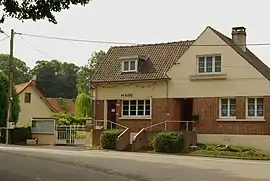 The town hall of Humieres | |
 Coat of arms | |
Location of Humières | |
 Humières  Humières | |
| Coordinates: 50°23′20″N 2°12′29″E / 50.3889°N 2.2081°E | |
| Country | France |
| Region | Hauts-de-France |
| Department | Pas-de-Calais |
| Arrondissement | Arras |
| Canton | Saint-Pol-sur-Ternoise |
| Intercommunality | CC Ternois |
| Government | |
| • Mayor (2020–2026) | Sébastien Bocquillon[1] |
| Area 1 | 6.81 km2 (2.63 sq mi) |
| Population | 210 |
| • Density | 31/km2 (80/sq mi) |
| Time zone | UTC+01:00 (CET) |
| • Summer (DST) | UTC+02:00 (CEST) |
| INSEE/Postal code | 62468 /62130 |
| Elevation | 83–133 m (272–436 ft) (avg. 128 m or 420 ft) |
| 1 French Land Register data, which excludes lakes, ponds, glaciers > 1 km2 (0.386 sq mi or 247 acres) and river estuaries. | |
Humières (French pronunciation: [ymjɛʁ]) is a commune in the Pas-de-Calais department in the Hauts-de-France region of France.[3]
Geography
A farming village situated 28 miles (45 km) west of Arras, at the junction of the N39, D105 and the D98 roads.
Population
| Year | Pop. | ±% p.a. |
|---|---|---|
| 1968 | 248 | — |
| 1975 | 224 | −1.44% |
| 1982 | 243 | +1.17% |
| 1990 | 219 | −1.29% |
| 1999 | 232 | +0.64% |
| 2007 | 228 | −0.22% |
| 2012 | 217 | −0.98% |
| 2017 | 229 | +1.08% |
| Source: INSEE[4] | ||
Places of interest
- The church of St. Martin, dating from the seventeenth century.
- The eighteenth-century chateau.
See also
References
- ↑ "Répertoire national des élus: les maires". data.gouv.fr, Plateforme ouverte des données publiques françaises (in French). 9 August 2021.
- ↑ "Populations légales 2021". The National Institute of Statistics and Economic Studies. 28 December 2023.
- ↑ INSEE commune file
- ↑ Population en historique depuis 1968, INSEE
Wikimedia Commons has media related to Humières.
This article is issued from Wikipedia. The text is licensed under Creative Commons - Attribution - Sharealike. Additional terms may apply for the media files.