Morchies | |
|---|---|
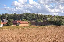 A general view of Morchies | |
 Coat of arms | |
Location of Morchies | |
 Morchies  Morchies | |
| Coordinates: 50°08′20″N 2°57′22″E / 50.1389°N 2.9561°E | |
| Country | France |
| Region | Hauts-de-France |
| Department | Pas-de-Calais |
| Arrondissement | Arras |
| Canton | Bapaume |
| Intercommunality | CC Sud-Artois |
| Government | |
| • Mayor (2020–2026) | Evelyne Dromart[1] |
| Area 1 | 6.64 km2 (2.56 sq mi) |
| Population | 209 |
| • Density | 31/km2 (82/sq mi) |
| Time zone | UTC+01:00 (CET) |
| • Summer (DST) | UTC+02:00 (CEST) |
| INSEE/Postal code | 62591 /62124 |
| Elevation | 85–117 m (279–384 ft) (avg. 93 m or 305 ft) |
| 1 French Land Register data, which excludes lakes, ponds, glaciers > 1 km2 (0.386 sq mi or 247 acres) and river estuaries. | |
Morchies (French pronunciation: [mɔʁʃi]) is a commune in the Pas-de-Calais department in the Hauts-de-France region of France.[3]
Geography
Morchies is situated 17 miles (27 km) southeast of Arras, on the D18 road.
Population
| Year | Pop. | ±% p.a. |
|---|---|---|
| 1968 | 227 | — |
| 1975 | 252 | +1.50% |
| 1982 | 201 | −3.18% |
| 1990 | 174 | −1.79% |
| 1999 | 189 | +0.92% |
| 2007 | 179 | −0.68% |
| 2012 | 178 | −0.11% |
| 2017 | 210 | +3.36% |
| Source: INSEE[4] | ||
Places of interest
- The church of St.Vaast, rebuilt, as was all of the village, after World War I.
- The three Commonwealth War Graves Commission cemeteries.
See also
References
- ↑ "Répertoire national des élus: les maires". data.gouv.fr, Plateforme ouverte des données publiques françaises (in French). 2 December 2020.
- ↑ "Populations légales 2021". The National Institute of Statistics and Economic Studies. 28 December 2023.
- ↑ INSEE commune file
- ↑ Population en historique depuis 1968, INSEE
External links
Wikimedia Commons has media related to Morchies.
This article is issued from Wikipedia. The text is licensed under Creative Commons - Attribution - Sharealike. Additional terms may apply for the media files.