Clenleu | |
|---|---|
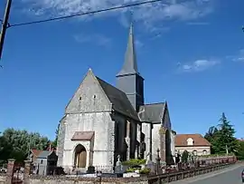 The church of Clenleu | |
 Coat of arms | |
Location of Clenleu | |
 Clenleu  Clenleu | |
| Coordinates: 50°31′25″N 1°52′17″E / 50.5236°N 1.8714°E / 50.5236; 1.8714 | |
| Country | France |
| Region | Hauts-de-France |
| Department | Pas-de-Calais |
| Arrondissement | Montreuil |
| Canton | Lumbres |
| Intercommunality | CC Haut Pays du Montreuillois |
| Government | |
| • Mayor (2020–2026) | Hervé Davelu[1] |
| Area 1 | 7.26 km2 (2.80 sq mi) |
| Population | 186 |
| • Density | 26/km2 (66/sq mi) |
| Time zone | UTC+01:00 (CET) |
| • Summer (DST) | UTC+02:00 (CEST) |
| INSEE/Postal code | 62227 /62650 |
| Elevation | 57–166 m (187–545 ft) (avg. 71 m or 233 ft) |
| 1 French Land Register data, which excludes lakes, ponds, glaciers > 1 km2 (0.386 sq mi or 247 acres) and river estuaries. | |
Clenleu (French pronunciation: [klɑ̃lø]) is a commune in the Pas-de-Calais department in the Hauts-de-France region of France.[3]
Geography
A village situated some 5 miles (8 km) northeast of Montreuil-sur-Mer on the D152 and D128 road junction.
Population
| Year | Pop. | ±% p.a. |
|---|---|---|
| 1968 | 182 | — |
| 1975 | 170 | −0.97% |
| 1982 | 181 | +0.90% |
| 1990 | 172 | −0.64% |
| 1999 | 183 | +0.69% |
| 2007 | 172 | −0.77% |
| 2012 | 189 | +1.90% |
| 2017 | 195 | +0.63% |
| Source: INSEE[4] | ||
See also
References
- ↑ "Répertoire national des élus: les maires" (in French). data.gouv.fr, Plateforme ouverte des données publiques françaises. 13 September 2022.
- ↑ "Populations légales 2021". The National Institute of Statistics and Economic Studies. 28 December 2023.
- ↑ INSEE commune file
- ↑ Population en historique depuis 1968, INSEE
Wikimedia Commons has media related to Clenleu.
This article is issued from Wikipedia. The text is licensed under Creative Commons - Attribution - Sharealike. Additional terms may apply for the media files.