Souastre | |
|---|---|
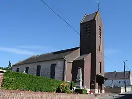 The church of Souastre | |
 Coat of arms | |
Location of Souastre | |
 Souastre  Souastre | |
| Coordinates: 50°09′11″N 2°33′54″E / 50.1531°N 2.565°E / 50.1531; 2.565 | |
| Country | France |
| Region | Hauts-de-France |
| Department | Pas-de-Calais |
| Arrondissement | Arras |
| Canton | Avesnes-le-Comte |
| Intercommunality | CC Sud-Artois |
| Government | |
| • Mayor (2020–2026) | Thierry Roucou[1] |
| Area 1 | 7.24 km2 (2.80 sq mi) |
| Population | 377 |
| • Density | 52/km2 (130/sq mi) |
| Time zone | UTC+01:00 (CET) |
| • Summer (DST) | UTC+02:00 (CEST) |
| INSEE/Postal code | 62800 /62111 |
| Elevation | 119–165 m (390–541 ft) (avg. 139 m or 456 ft) |
| 1 French Land Register data, which excludes lakes, ponds, glaciers > 1 km2 (0.386 sq mi or 247 acres) and river estuaries. | |
Souastre is a commune in the Pas-de-Calais department in the Hauts-de-France region of France.[3]
Geography
Souastre lies 15 miles (24 km) southwest of Arras, at the junction of the D2, D6 and D23 roads.
Population
| Year | Pop. | ±% p.a. |
|---|---|---|
| 1968 | 442 | — |
| 1975 | 434 | −0.26% |
| 1982 | 368 | −2.33% |
| 1990 | 352 | −0.55% |
| 1999 | 324 | −0.92% |
| 2007 | 339 | +0.57% |
| 2012 | 361 | +1.27% |
| 2017 | 379 | +0.98% |
| Source: INSEE[4] | ||
Places of interest
- Ruins of a watermill.
- The church of St.Vaast, dating from the seventeenth century.
See also
References
- ↑ "Répertoire national des élus: les maires". data.gouv.fr, Plateforme ouverte des données publiques françaises (in French). 9 August 2021.
- ↑ "Populations légales 2021". The National Institute of Statistics and Economic Studies. 28 December 2023.
- ↑ INSEE commune file
- ↑ Population en historique depuis 1968, INSEE
Wikimedia Commons has media related to Souastre.
This article is issued from Wikipedia. The text is licensed under Creative Commons - Attribution - Sharealike. Additional terms may apply for the media files.