Hermin | |
|---|---|
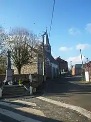 The centre of Hermin | |
 Coat of arms | |
Location of Hermin | |
 Hermin  Hermin | |
| Coordinates: 50°25′09″N 2°33′36″E / 50.4192°N 2.56°E | |
| Country | France |
| Region | Hauts-de-France |
| Department | Pas-de-Calais |
| Arrondissement | Béthune |
| Canton | Bruay-la-Buissière |
| Intercommunality | CA Béthune-Bruay, Artois-Lys Romane |
| Government | |
| • Mayor (2020–2026) | Jean-Luc Leclercq[1] |
| Area 1 | 4.19 km2 (1.62 sq mi) |
| Population | 208 |
| • Density | 50/km2 (130/sq mi) |
| Time zone | UTC+01:00 (CET) |
| • Summer (DST) | UTC+02:00 (CEST) |
| INSEE/Postal code | 62441 /62150 |
| Elevation | 89–165 m (292–541 ft) (avg. 112 m or 367 ft) |
| 1 French Land Register data, which excludes lakes, ponds, glaciers > 1 km2 (0.386 sq mi or 247 acres) and river estuaries. | |
Hermin (French pronunciation: [ɛʁmɛ̃]) is a commune in the Pas-de-Calais department in the Hauts-de-France region of France.[3]
Geography
A small farming village, situated some 14 miles (23 km) northwest of Arras on the D72 near its junction with the D341 road. A small stream, the Hermin, flows through the commune.
Population
| Year | Pop. | ±% p.a. |
|---|---|---|
| 1968 | 219 | — |
| 1975 | 203 | −1.08% |
| 1982 | 189 | −1.02% |
| 1990 | 204 | +0.96% |
| 1999 | 199 | −0.28% |
| 2007 | 215 | +0.97% |
| 2012 | 211 | −0.37% |
| 2017 | 213 | +0.19% |
| Source: INSEE[4] | ||
Places of interest
See also
References
- ↑ "Répertoire national des élus: les maires". data.gouv.fr, Plateforme ouverte des données publiques françaises (in French). 9 August 2021.
- ↑ "Populations légales 2021". The National Institute of Statistics and Economic Studies. 28 December 2023.
- ↑ INSEE commune file
- ↑ Population en historique depuis 1968, INSEE
Wikimedia Commons has media related to Hermin.
This article is issued from Wikipedia. The text is licensed under Creative Commons - Attribution - Sharealike. Additional terms may apply for the media files.