Blyes | |
|---|---|
Commune | |
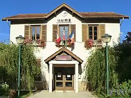 Town hall | |
.svg.png.webp) Coat of arms | |
Location of Blyes | |
 Blyes  Blyes | |
| Coordinates: 45°51′N 5°15′E / 45.85°N 5.25°E | |
| Country | France |
| Region | Auvergne-Rhône-Alpes |
| Department | Ain |
| Arrondissement | Belley |
| Canton | Lagnieu |
| Intercommunality | Plaine de l'Ain |
| Government | |
| • Mayor (2020–2026) | Daniel Martin[1] |
| Area 1 | 12.27 km2 (4.74 sq mi) |
| Population | 1,292 |
| • Density | 110/km2 (270/sq mi) |
| Time zone | UTC+01:00 (CET) |
| • Summer (DST) | UTC+02:00 (CEST) |
| INSEE/Postal code | 01047 /01150 |
| Elevation | 199–243 m (653–797 ft) (avg. 210 m or 690 ft) |
| 1 French Land Register data, which excludes lakes, ponds, glaciers > 1 km2 (0.386 sq mi or 247 acres) and river estuaries. | |
Blyes (French pronunciation: [bli]) is a commune in the Ain department in eastern France.
Geography
Blyes lies 8 km from Lagnieu, 5 km from the A42, 10 km from Meximieux, 4 km from Saint-Vulbas, and 6 km from Chazey-sur-Ain. It is located not far from the river Ain.
Population
| Year | Pop. | ±% p.a. |
|---|---|---|
| 1968 | 147 | — |
| 1975 | 228 | +6.47% |
| 1982 | 359 | +6.70% |
| 1990 | 535 | +5.11% |
| 1999 | 692 | +2.90% |
| 2007 | 927 | +3.72% |
| 2012 | 915 | −0.26% |
| 2017 | 1,007 | +1.93% |
| Source: INSEE[3] | ||
See also
References
- ↑ "Répertoire national des élus: les maires". data.gouv.fr, Plateforme ouverte des données publiques françaises (in French). 2 December 2020.
- ↑ "Populations légales 2021". The National Institute of Statistics and Economic Studies. 28 December 2023.
- ↑ Population en historique depuis 1968, INSEE
External links
Wikimedia Commons has media related to Blyes.
This article is issued from Wikipedia. The text is licensed under Creative Commons - Attribution - Sharealike. Additional terms may apply for the media files.