Saint-Trivier-sur-Moignans | |
|---|---|
Commune | |
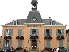 Town hall | |
.svg.png.webp) Coat of arms | |
Location of Saint-Trivier-sur-Moignans | |
 Saint-Trivier-sur-Moignans  Saint-Trivier-sur-Moignans | |
| Coordinates: 46°04′00″N 4°54′00″E / 46.0667°N 4.9°E | |
| Country | France |
| Region | Auvergne-Rhône-Alpes |
| Department | Ain |
| Arrondissement | Bourg-en-Bresse |
| Canton | Villars-les-Dombes |
| Intercommunality | Dombes |
| Government | |
| • Mayor (2020–2026) | Marcel Lanier[1] |
| Area 1 | 41.99 km2 (16.21 sq mi) |
| Population | 1,857 |
| • Density | 44/km2 (110/sq mi) |
| Time zone | UTC+01:00 (CET) |
| • Summer (DST) | UTC+02:00 (CEST) |
| INSEE/Postal code | 01389 /01990 |
| Elevation | 230–289 m (755–948 ft) (avg. 255 m or 837 ft) |
| 1 French Land Register data, which excludes lakes, ponds, glaciers > 1 km2 (0.386 sq mi or 247 acres) and river estuaries. | |
Saint-Trivier-sur-Moignans (French pronunciation: [sɛ̃ tʁivje syʁ mwaɲɑ̃]; Arpitan: Sent-Treviér) is a commune in the Ain department in eastern France.
Population
| Year | Pop. | ±% p.a. |
|---|---|---|
| 1968 | 1,140 | — |
| 1975 | 1,151 | +0.14% |
| 1982 | 1,233 | +0.99% |
| 1990 | 1,471 | +2.23% |
| 1999 | 1,537 | +0.49% |
| 2007 | 1,864 | +2.44% |
| 2012 | 1,817 | −0.51% |
| 2017 | 1,799 | −0.20% |
| Source: INSEE[3] | ||
See also
References
- ↑ "Répertoire national des élus: les maires". data.gouv.fr, Plateforme ouverte des données publiques françaises (in French). 2 December 2020.
- ↑ "Populations légales 2021". The National Institute of Statistics and Economic Studies. 28 December 2023.
- ↑ Population en historique depuis 1968, INSEE
Wikimedia Commons has media related to Saint-Trivier-sur-Moignans.
This article is issued from Wikipedia. The text is licensed under Creative Commons - Attribution - Sharealike. Additional terms may apply for the media files.