Courmangoux | |
|---|---|
Commune | |
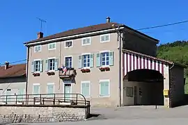 Town hall | |
.svg.png.webp) Coat of arms | |
Location of Courmangoux | |
 Courmangoux  Courmangoux | |
| Coordinates: 46°19′55″N 5°22′11″E / 46.3319°N 5.3697°E | |
| Country | France |
| Region | Auvergne-Rhône-Alpes |
| Department | Ain |
| Arrondissement | Bourg-en-Bresse |
| Canton | Saint-Étienne-du-Bois |
| Intercommunality | CA Bassin de Bourg-en-Bresse |
| Government | |
| • Mayor (2020–2026) | Mireille Mornay[1] |
| Area 1 | 14.82 km2 (5.72 sq mi) |
| Population | 504 |
| • Density | 34/km2 (88/sq mi) |
| Time zone | UTC+01:00 (CET) |
| • Summer (DST) | UTC+02:00 (CEST) |
| INSEE/Postal code | 01127 /01370 |
| Elevation | 211–652 m (692–2,139 ft) (avg. 300 m or 980 ft) |
| 1 French Land Register data, which excludes lakes, ponds, glaciers > 1 km2 (0.386 sq mi or 247 acres) and river estuaries. | |
Courmangoux (French pronunciation: [kuʁmɑ̃ɡu]) is a commune in the Ain department in eastern France.
Population
| Year | Pop. | ±% p.a. |
|---|---|---|
| 1968 | 354 | — |
| 1975 | 296 | −2.52% |
| 1982 | 310 | +0.66% |
| 1990 | 327 | +0.67% |
| 1999 | 360 | +1.07% |
| 2009 | 495 | +3.24% |
| 2014 | 508 | +0.52% |
| 2020 | 506 | −0.07% |
| Source: INSEE[3] | ||
See also
References
- ↑ "Répertoire national des élus: les maires". data.gouv.fr, Plateforme ouverte des données publiques françaises (in French). 2 December 2020.
- ↑ "Populations légales 2021". The National Institute of Statistics and Economic Studies. 28 December 2023.
- ↑ Population en historique depuis 1968, INSEE
Wikimedia Commons has media related to Courmangoux.
This article is issued from Wikipedia. The text is licensed under Creative Commons - Attribution - Sharealike. Additional terms may apply for the media files.