Montracol | |
|---|---|
Commune | |
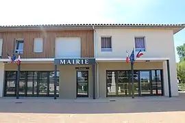 Town hall | |
Location of Montracol | |
 Montracol  Montracol | |
| Coordinates: 46°11′00″N 5°07′00″E / 46.1833°N 5.1167°E | |
| Country | France |
| Region | Auvergne-Rhône-Alpes |
| Department | Ain |
| Arrondissement | Bourg-en-Bresse |
| Canton | Attignat |
| Intercommunality | CA Bassin de Bourg-en-Bresse |
| Government | |
| • Mayor (2020–2026) | David Lafont[1] |
| Area 1 | 14.56 km2 (5.62 sq mi) |
| Population | 1,008 |
| • Density | 69/km2 (180/sq mi) |
| Time zone | UTC+01:00 (CET) |
| • Summer (DST) | UTC+02:00 (CEST) |
| INSEE/Postal code | 01264 /01310 |
| Elevation | 211–258 m (692–846 ft) |
| 1 French Land Register data, which excludes lakes, ponds, glaciers > 1 km2 (0.386 sq mi or 247 acres) and river estuaries. | |
Montracol (French pronunciation: [mɔ̃ʁakɔl]) is a commune in the Ain department in eastern France.
Population
| Year | Pop. | ±% p.a. |
|---|---|---|
| 1968 | 429 | — |
| 1975 | 450 | +0.69% |
| 1982 | 584 | +3.79% |
| 1990 | 551 | −0.72% |
| 1999 | 619 | +1.30% |
| 2009 | 957 | +4.45% |
| 2014 | 1,013 | +1.14% |
| 2020 | 1,017 | +0.07% |
| Source: INSEE[3] | ||
See also
References
- ↑ "Répertoire national des élus: les maires" (in French). data.gouv.fr, Plateforme ouverte des données publiques françaises. 13 September 2022.
- ↑ "Populations légales 2021". The National Institute of Statistics and Economic Studies. 28 December 2023.
- ↑ Population en historique depuis 1968, INSEE
Wikimedia Commons has media related to Montracol.
This article is issued from Wikipedia. The text is licensed under Creative Commons - Attribution - Sharealike. Additional terms may apply for the media files.