Chevroux | |
|---|---|
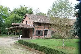 La Bourlière farm | |
.svg.png.webp) Coat of arms | |
Location of Chevroux | |
 Chevroux  Chevroux | |
| Coordinates: 46°22′53″N 4°56′58″E / 46.3814°N 4.9494°E | |
| Country | France |
| Region | Auvergne-Rhône-Alpes |
| Department | Ain |
| Arrondissement | Bourg-en-Bresse |
| Canton | Replonges |
| Intercommunality | Bresse et Saône |
| Government | |
| • Mayor (2020–2026) | Dominique Savot[1] |
| Area 1 | 17.2 km2 (6.6 sq mi) |
| Population | 973 |
| • Density | 57/km2 (150/sq mi) |
| Time zone | UTC+01:00 (CET) |
| • Summer (DST) | UTC+02:00 (CEST) |
| INSEE/Postal code | 01102 /01190 |
| Elevation | 176–208 m (577–682 ft) (avg. 200 m or 660 ft) |
| 1 French Land Register data, which excludes lakes, ponds, glaciers > 1 km2 (0.386 sq mi or 247 acres) and river estuaries. | |
Chevroux (French pronunciation: [ʃəvʁu] ⓘ) is a commune in the Ain department in eastern France.
Population
| Year | Pop. | ±% p.a. |
|---|---|---|
| 1968 | 587 | — |
| 1975 | 516 | −1.82% |
| 1982 | 517 | +0.03% |
| 1990 | 586 | +1.58% |
| 1999 | 657 | +1.28% |
| 2007 | 847 | +3.23% |
| 2012 | 941 | +2.13% |
| 2017 | 952 | +0.23% |
| Source: INSEE[3] | ||
See also
References
- ↑ "Répertoire national des élus: les maires" (in French). data.gouv.fr, Plateforme ouverte des données publiques françaises. 13 September 2022.
- ↑ "Populations légales 2021". The National Institute of Statistics and Economic Studies. 28 December 2023.
- ↑ Population en historique depuis 1968, INSEE
Wikimedia Commons has media related to Chevroux, Ain.
This article is issued from Wikipedia. The text is licensed under Creative Commons - Attribution - Sharealike. Additional terms may apply for the media files.